Monsoon moisture could bring heavy rainfall and potential flooding to southeast New Mexico and most of the state Tuesday and Wednesday, according to the National Weather Service.
Chaves and Eddy counties are two of 31 counties across the state as of early Tuesday to be under a flood watch by the National Weather Service between noon Tuesday through Wednesday afternoon, with two to three inches expected in Roswell and up to 1.25 inches and 1.75 inches predicted in Carlsbad and Artesia, respectively said Todd Shoemake, meteorologist with the National Weather Service in Albuquerque.
And strong chances of rain were also expected to continue through the week as Roswell posed up to an 80% chance of rain on Wednesday, 60% on Thursday and a 70% chance of rain on Friday, according to the forecast from the National Weather Service
Carlsbad had up to a 60% chance of rain Wednesday, followed by up to 80% on Thursday and 70% chance on Friday, the weather service predicted. Artesia had a slightly stronger chance with up to 70% on Wednesday, and 90% chance on Thursday night, followed by and 80% chance at rainfall on Friday.
As of Tuesday morning, Curry and Roosevelt counties in New Mexico are the only counties not under a flood watch.
The week’s rainfall was expected to begin at about noon Tuesday with scattered showers and thunderstorms before becoming more widespread and intense going into Tuesday night in Roswell with 0.5 to 1.25 inches expected, Shoemake said. Rain will persist Wednesday and Wednesday night, with rainfall of between 0.75 inches and 1.75 inches forecasted. Rainfall could potentially hit three to six inches in parts of northern Chaves County.
Although Eddy County is under a flood watch, Shoemake said the cities of Artesia and Carlsbad are expected to see much less rainfall between Tuesday and through Wednesday night. Artesia is forecast to receive between 1 and 1.75 inches and Carlsbad between 0.75 and 1.25 inches.
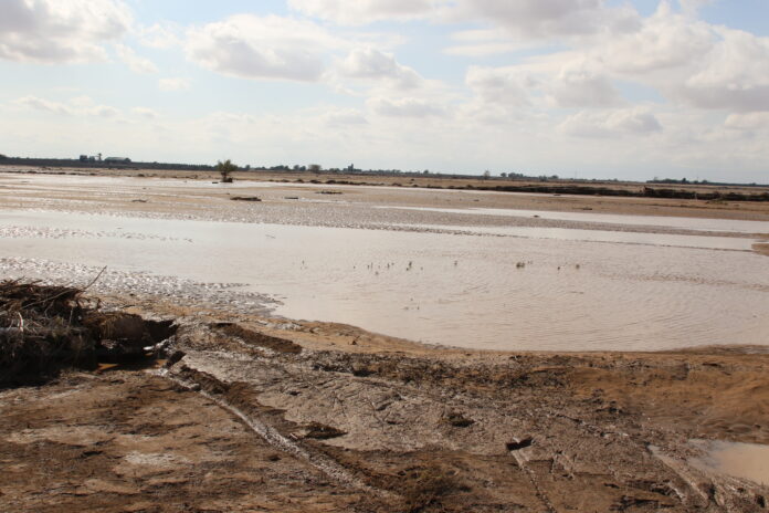
Forecasts are not expecting any catastrophic flooding for Chaves County on the level of October 2024, when six to seven inches of rain fell within a couple hours, leading to widespread flooding throughout the county and significant property damage along the Spring River Corridor. Shoemake said that is because unlike the flood of 2024, the rain forecasted for Tuesday and Wednesday is expected to fall over the course of two days.
The two days of rainfall also bring the possibility of flooding across the state, and significant rises in water levels in the Pecos River, Rio Felix and other rivers in southeast New Mexico that could meet or exceed their banks, Shoemake said. But it likely won’t mean a return to average precipitation in Chaves County, where 5.97 inches of rain fell since Jan. 1 compared with the average 8.84 inches for this time of year.
And most of that comes during monsoon season, when Shoemake said the region typically receives about half of its moisture for the year.
In the short-term, local and state officials are bracing for the coming rains. Flash flooding and runoff in mountainous and burn scarred areas, low-lying arroyos and locations with poor drainage could present hazards for motorists, according to a news release from the New Mexico Department of Transportation.
Motorists should be prepared for rapidly changing road conditions, reduced visibility, standing water, debris and possible road closures and limit unnecessary travel, the release said. Officials warn that people on the roads should use caution.
“If you come across a flooded roadway, do not take the chance of trying to cross it. Find a safe alternate route and remember that getting there safely is more important than getting there quickly,” said Francisco Sanchez, engineer for the New Mexico Department of Transportation District 2.
Where to get sandbags
Tuesday at noon, pre-filled sandbags were delivered to the following volunteer fire departments, with residents limited to 10 sandbags per day:
Berrendo Fire Station 2, 909 Wiggins Rd
Berrendo Fire Station 3, 4603 Navajo Dr
Sierra Fire Station 1, 603 South Brown Rd
Sierra Fire Station 2, 5108 South Lea Ave
Midway Fire Station 2, 63 Honolulu Rd
Midway Fire Station 1, 6477 Templeton St
Chaves County Road Department, 1505 East Brasher Rd
The Chaves County Flood Commission is also operating a separate station where residents can fill their own sandbags at 207 North Brown Rd, according to the post. Sand and sandbags will be provided but residents are asked to bring their own shovels to fill those bags.