
Sean Chaffin
For the Ruidoso News
Hikers received some unwelcome news over the last few weeks with the closing of several major trail systems in the Ruidoso area, as trails at Alto Lake, Cedar Creek, and Perk Canyon are off limits to area adventurers for a few weeks.
The Eagle Creek trail and the disc golf course at Alto Lake, below the dam, will be closed through the end of August as the area undergoes post-fire work, including the removal of dead trees and woody debris, mastication, and erosion control work to help stabilize burned slopes and reduce erosion.
The U.S. Forest Service has also temporarily closed the Cedar Creek and Perk Canyon trails through monsoon season due to potentially hazardous flooding conditions. Despite the closures, 1.1 million acres in the Lincoln National Forest remain open, including 600 miles of open trails for hiking, biking, and more.
Other nearby areas also offer a chance to get out and enjoy some nature as well. Here’s a quick look at just some of the options in the area outdoors lovers may want to consider.
Grindstone Reservoir
There are several trails to choose from for hiking and biking, along with fishing, disc golf, horseback riding and other outdoor activities. The Grindstone Canyon Loop is a moderate trail offering 6.6 miles through the wilderness. Grindstone Lake to Winchester Road offers an easier trail of 1.9 miles. The Grindstone Mesa Trail offers another 3.6 miles of moderate hiking terrain.
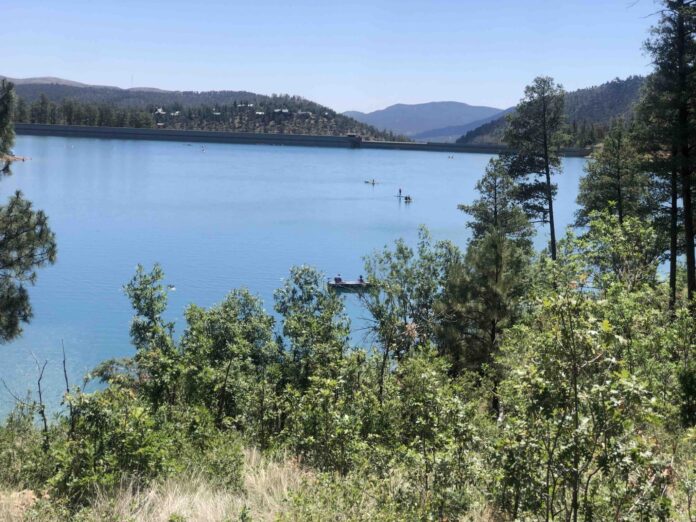
There is a wide variety for those looking to get outdoors and the brilliant blue lake offers the perfect backdrop for a day on the trails with friends and family.
Sawmill Trail
Those who enjoy Grindstone-area hiking may want to add this to the itinerary. This 3.9-mile connector trail links to the Grindstone trail system. The trailhead is located on Mud Canyon Road at the end of Bewley Lane, off Carrizo Canyon Road. A sign makes finding the trailhead easy.
Lookout Mountain/Crest Trail
This option offers a more challenging route than some others and is located near Ski Apache. The Lookout Mountain via Crest and Scenic Trails offers brilliant views as part of a 7.1-mile out-and-back route. Expect an arduous and steep ascent with 1,900 feet of elevation change with spectacular wildflower views in spring and summer.
Moon Mountain Recreation Area
Expect a rocky experience on this climb up Moon Mountain for 360-degree views of surrounding mountainside and the village below. This is a moderately challenging course on a 4.5-mile loop, and the recreation area also features a disc golf course. Look for the trailhead near Gavalan Canyon Road and Warrior Drive.
Capitan trails
The Capitan area offers miles of trails, and the Kit Carson Loop offers an easier trek featuring 3.7 miles of high desert hills and wonderful mountain views, including chances to view Sierra Blanca. Look for the trailhead about two miles north of Fort Stanton on N.M. 220.
The Capitan Peak Trail offers a more challenging journey with a 12.2-mile out-and-back and is popular with serious backpackers and campers.
Cloudcroft trails
For those looking for something a little different, head to Cloudcroft for some fantastic views of nature, wildflowers, and a variety of trees, including a multitude of aspens. The OSHA Trail is one of the most popular and presents a 2.5-mile loop that is perfect for moderate-level hikers.
Expect some challenging ascents with a great view of the Mexican Canyon Trestle, which was part of a train service that brought visitors and workers from Alamogordo to Cloudcroft for almost five decades, beginning in 1899. The trailhead is located just west of the village on the north side of U.S. Highway 82, near Muchachita Street. There are numerous other trails in Cloudcroft worth strapping on the hiking boots for.
Tularosa/Alamogordo area
The Three Rivers Petroglyph Site, located at 455 3 Rivers Road in Tularosa, is overseen by the Bureau of Land Management and features over 21,000 petroglyphs, including masks, sunbursts, wildlife, handprints, and geometric designs. A rugged 1/2-mile petroglyph trail takes visitors on a journey to view some of the Southwest’s best examples of prehistoric rock art. An additional short trail leads adventurers to a partially excavated prehistoric village.
The Tularosa Falls campground offers a chance to explore the surrounding canyons and take a dip in the three natural pools below the 25-foot natural waterfall. Guests are allowed by either camping or paying $10 for a day pass.
The Dune Life Nature Trail is a short loop hike within White Sands National Park, with the chance to observe tracks of various animals that call this unique environment home. Keep an eye out for foxes, badgers, birds, rodents, reptiles and more.
This is just a small sample of what awaits hikers in the area who may want to put some more trips on the itinerary. As always, practice safe hiking when heading outdoors and be weather-aware as monsoon season gets underway.